
Commute to downtown by ZIP code
An interactive U.S. map of commute to downtown for ZIP codes. Latest data: Leaving 8 am local time on a weekday, by car. PLUS
Open commute to downtown on the map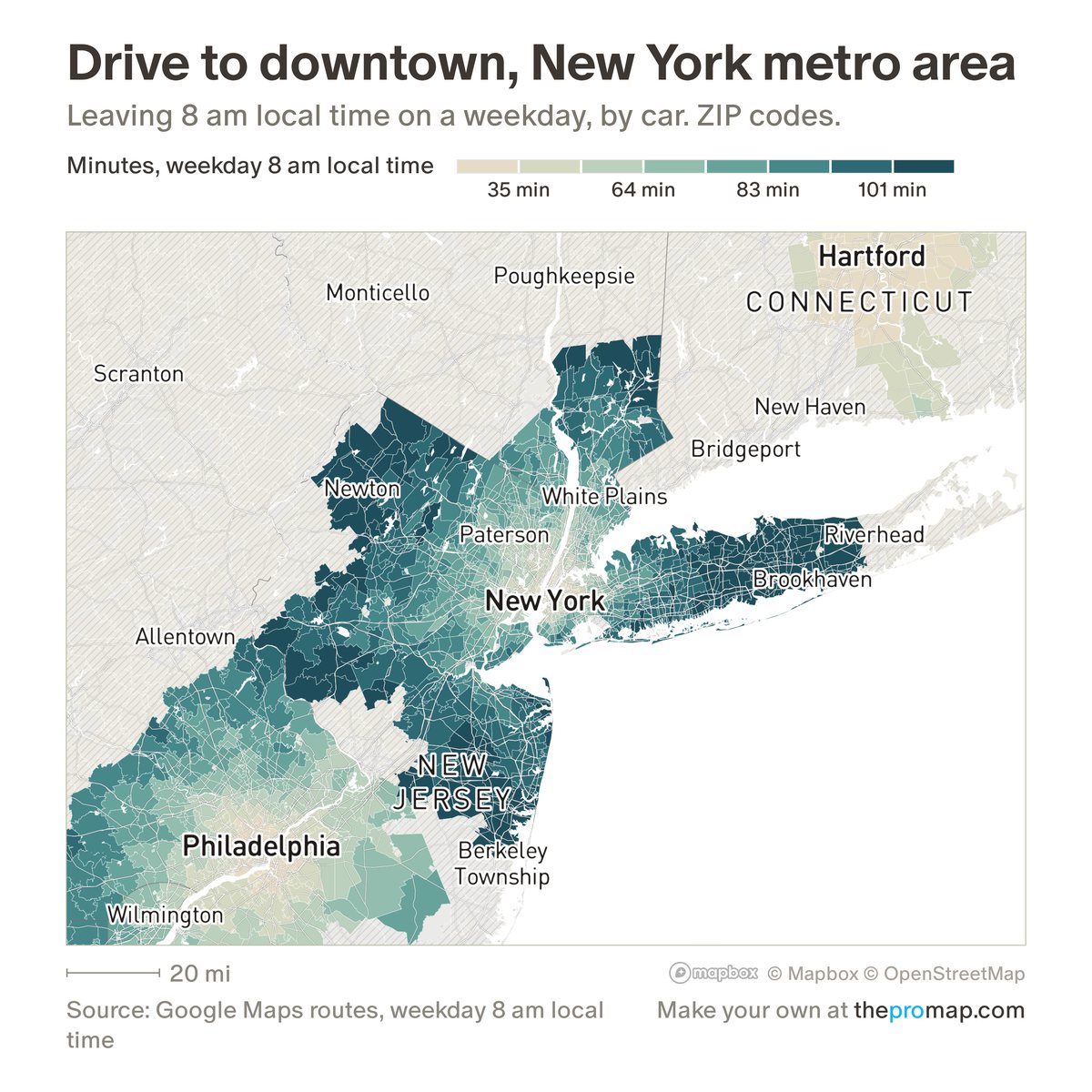
What this measure is
Minutes from each ZIP code to the downtown of its own metro area, from Google Maps routes for a weekday (Tuesday) departure at 8 am local time, with Google's typical traffic for that hour. The Car, Transit and Fastest buttons show the drive in that traffic, the trip by public transit, or the quicker of the two; in Fastest, hatched ZIP codes are those where transit is faster. Times exist for about 7,100 ZIP codes in the largest metro areas (transit for about 4,300), and Central-time metros such as Chicago, Dallas and Houston use a 7 am departure.
Source, dates and coverage
- Source
- Google Maps routes, requested by Home Economics.
- Updated
- Requested once: Eastern and Central times in June 2026, western times in November 2026. Not refreshed on a schedule. Latest data on the map: Leaving 8 am local time on a weekday, by car.
- Areas on the map
- ZIP codes.
- Group
- Commute
- Access
- ProMap Plus ($19 a month or $190 a year).
Values for every place
Commute to downtown is a ProMap Plus measure. The map shows it for the areas listed above. This page shows the map's national picture, the method and the source, and no figures.
ProMap Plus costs $19 a month or $190 a year. A free 7-day trial is offered on the map.
See commute to downtown in ProMap PlusHow to cite
Please also credit the original source: Google Maps routes, requested by Home Economics.