
Mortgage denial rate by county
An interactive U.S. map of mortgage denial rate for states, metro areas, counties and census tracts. Latest data: 2025. PLUS
Open mortgage denial rate on the map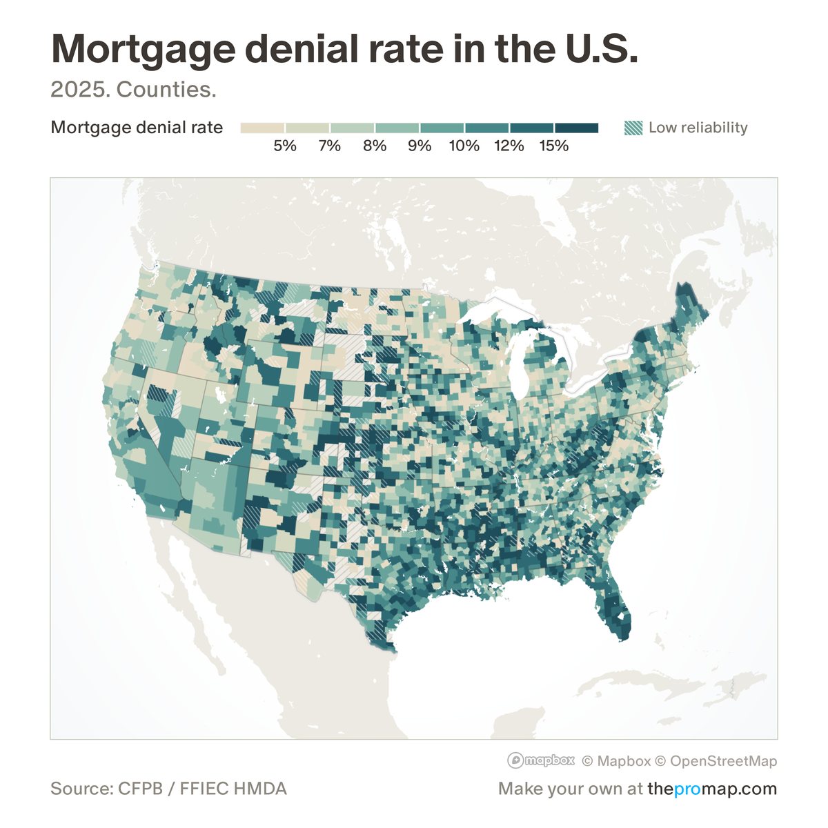
What this measure is
The share of applications for a home-purchase mortgage on the buyer's own home that lenders denied. Withdrawn and incomplete applications are left out, and so are manufactured homes, whose loans are denied far more often and would mostly show where manufactured homes are. White stripes over the colour mark low reliability: fewer than 30 applications.
Source, dates and coverage
- Source
- Consumer Financial Protection Bureau and Federal Financial Institutions Examination Council, Home Mortgage Disclosure Act loan records.
- Updated
- Once a year. Latest data on the map: 2025.
- Areas on the map
- States, metro areas, counties and census tracts.
- Group
- Mortgage lending (HMDA)
- Access
- ProMap Plus ($19 a month or $190 a year).
Values for every place
Mortgage denial rate is a ProMap Plus measure. The map shows it for the areas listed above. This page shows the map's national picture, the method and the source, and no figures.
ProMap Plus costs $19 a month or $190 a year. A free 7-day trial is offered on the map.
See mortgage denial rate in ProMap PlusHow to cite
Please also credit the original source: Consumer Financial Protection Bureau and Federal Financial Institutions Examination Council, Home Mortgage Disclosure Act loan records.