
Distance to rail transit by ZIP code
An interactive U.S. map of distance to rail transit for states, metro areas, counties and ZIP codes. PLUS
Open distance to rail transit on the map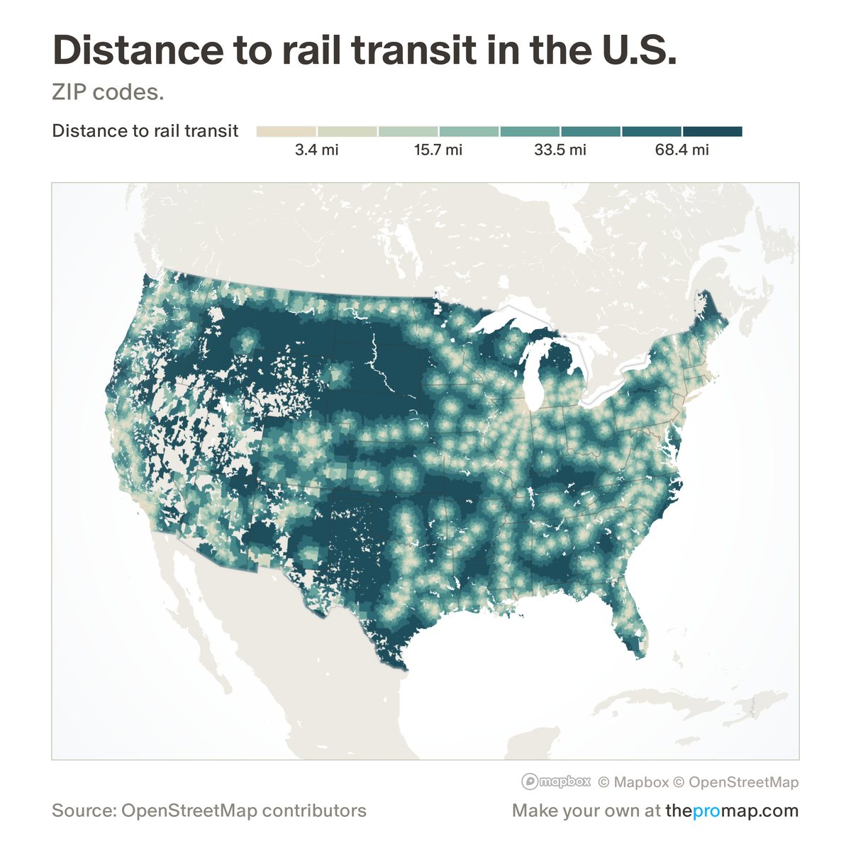
What this measure is
How far, in miles, the centre of each ZIP code is from the nearest railway station or stop mapped in OpenStreetMap. A small stop counts the same as a major station, and how often trains run is not considered. Counties, metros and states show the typical resident's ZIP: a population-weighted average of their ZIP codes.
Source, dates and coverage
- Source
- OpenStreetMap contributors; Home Economics calculation.
- Updated
- Rebuilt once a year from a new OpenStreetMap download.
- Areas on the map
- States, metro areas, counties and ZIP codes.
- Group
- Amenities & transit
- Access
- ProMap Plus ($19 a month or $190 a year).
Values for every place
Distance to rail transit is a ProMap Plus measure. The map shows it for the areas listed above. This page shows the map's national picture, the method and the source, and no figures.
ProMap Plus costs $19 a month or $190 a year. A free 7-day trial is offered on the map.
See distance to rail transit in ProMap PlusHow to cite
Please also credit the original source: OpenStreetMap contributors; Home Economics calculation.