
Tree cover by ZIP code
An interactive U.S. map of tree cover for states, metro areas, counties and ZIP codes. Latest data: 2025. PLUS
Open tree cover on the map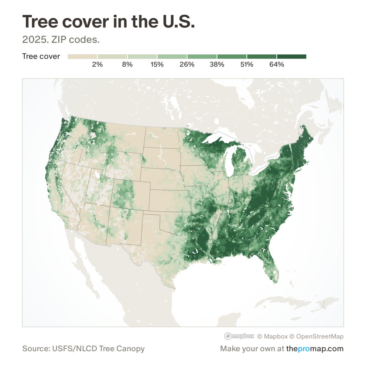
What this measure is
The share of land covered by tree canopy, from the Forest Service's 2025 tree canopy map, which is built from satellite images on a 30-metre grid. Lakes, rivers and bays are left out, so it is the share of land only. Hatched areas have no figure: the canopy map covers less than half their land, which includes most of Alaska.
Source, dates and coverage
- Source
- U.S. Forest Service and the National Land Cover Database, Tree Canopy Cover 2025.
- Updated
- Built from the 2025 canopy map; not updated on a schedule. Latest data on the map: 2025.
- Areas on the map
- States, metro areas, counties and ZIP codes.
- Group
- Amenities & transit
- Access
- ProMap Plus ($19 a month or $190 a year).
Values for every place
Tree cover is a ProMap Plus measure. The map shows it for the areas listed above. This page shows the map's national picture, the method and the source, and no figures.
ProMap Plus costs $19 a month or $190 a year. A free 7-day trial is offered on the map.
See tree cover in ProMap PlusHow to cite
Please also credit the original source: U.S. Forest Service and the National Land Cover Database, Tree Canopy Cover 2025.