
Presidential margin, 2024 by ZIP code
An interactive U.S. map of Presidential margin, 2024 for states, metro areas, counties, ZIP codes, census tracts and census block groups. Latest data: 2024. PLUS
Open Presidential margin, 2024 on the map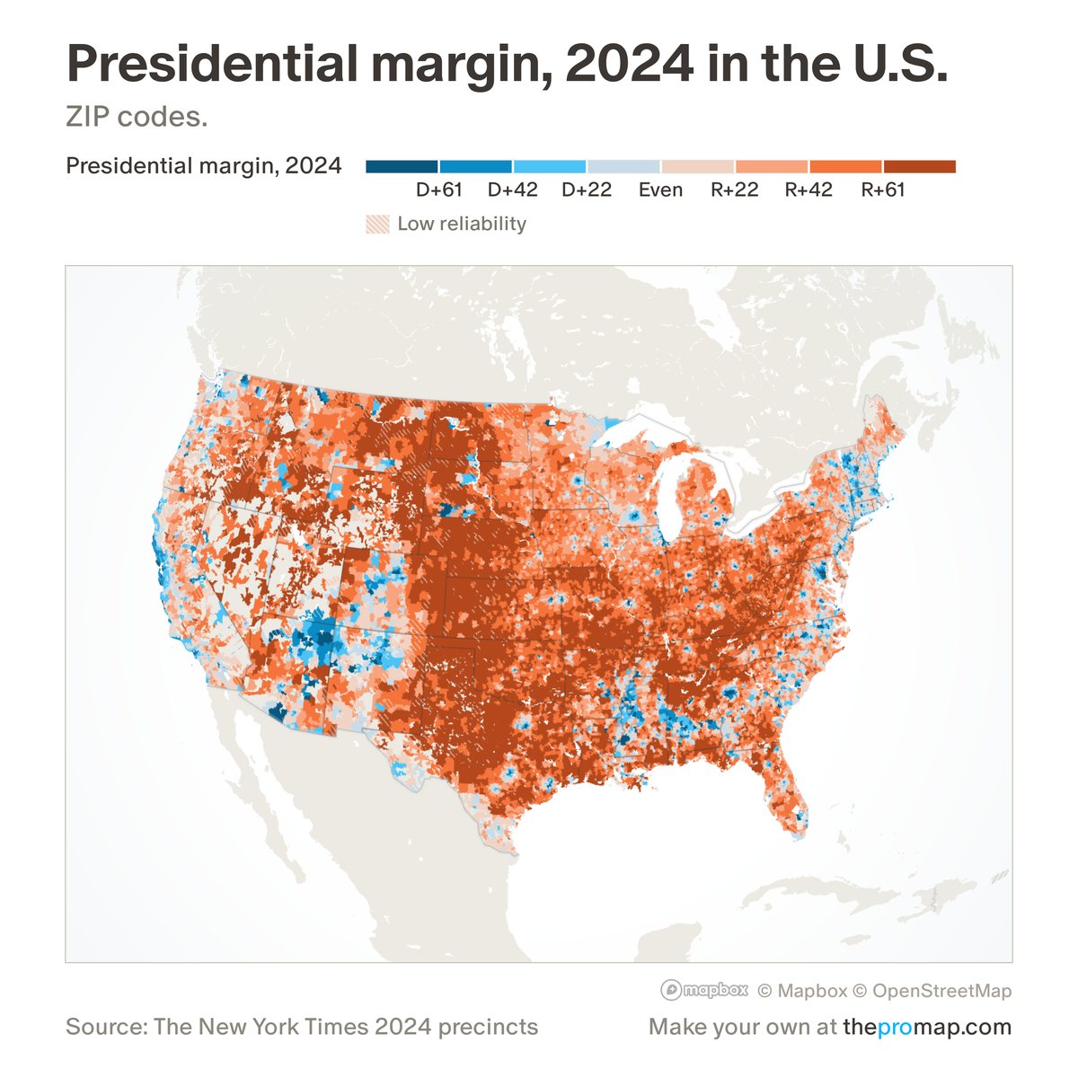
What this measure is
Trump's share of all votes for president minus the Democrat's (Clinton 2016, Biden 2020, Harris 2024), in percentage points: R+10 means Trump won by 10 points, D+10 the Democrat. States, counties and metro areas add up official results; ZIP codes, tracts, block groups and hexagons place precinct results on 2020 census blocks by population, so they are estimates. Changes compare 2024 with 2020 or 2016. White stripes over the colour mark low reliability: under 100 votes, or, for changes, most of the area's 2024 votes estimated from county totals.
Source, dates and coverage
- Source
- Voting and Election Science Team precinct maps (2016, 2020), The New York Times 2024 precinct map, official county totals.
- Updated
- Final results; not updated. Latest data on the map: 2024.
- Areas on the map
- States, metro areas, counties, ZIP codes, census tracts and census block groups.
- Group
- Politics
- Access
- ProMap Plus ($19 a month or $190 a year).
Values for every place
Presidential margin, 2024 is a ProMap Plus measure. The map shows it for the areas listed above. This page shows the map's national picture, the method and the source, and no figures.
ProMap Plus costs $19 a month or $190 a year. A free 7-day trial is offered on the map.
See Presidential margin, 2024 in ProMap PlusHow to cite
Please also credit the original source: Voting and Election Science Team precinct maps (2016, 2020), The New York Times 2024 precinct map, official county totals.