
Floodplain share by county
An interactive U.S. map of floodplain share for counties. Latest data: 2026. PLUS
Open floodplain share on the map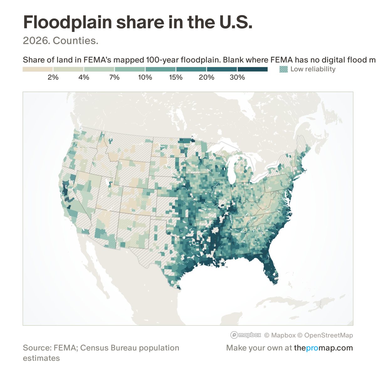
What this measure is
The share of a county's land inside FEMA's mapped 100-year floodplain: land with at least a 1% chance of flooding in any year. It measures land area, not buildings or people, and counts only FEMA's current official maps, not draft maps or unstudied areas. Hatched areas have no figure: FEMA has no digital flood map, or one covering less than half the county. White stripes over the colour mark low reliability: the map covers only 50–90% of the county, and the share is for the mapped part.
Source, dates and coverage
- Source
- FEMA National Flood Hazard Layer; Home Economics calculation.
- Updated
- A one-time snapshot, taken 8–9 November 2026. Latest data on the map: 2026.
- Areas on the map
- Counties.
- Group
- Climate & hazard risk
- Access
- ProMap Plus ($19 a month or $190 a year).
Values for every place
Floodplain share is a ProMap Plus measure. The map shows it for the areas listed above. This page shows the map's national picture, the method and the source, and no figures.
ProMap Plus costs $19 a month or $190 a year. A free 7-day trial is offered on the map.
See floodplain share in ProMap PlusHow to cite
Please also credit the original source: FEMA National Flood Hazard Layer; Home Economics calculation.