
Wildfire risk to homes by ZIP code
An interactive U.S. map of wildfire risk to homes for states, metro areas, counties, ZIP codes and census tracts. Latest data: 2024. PLUS
Open wildfire risk to homes on the map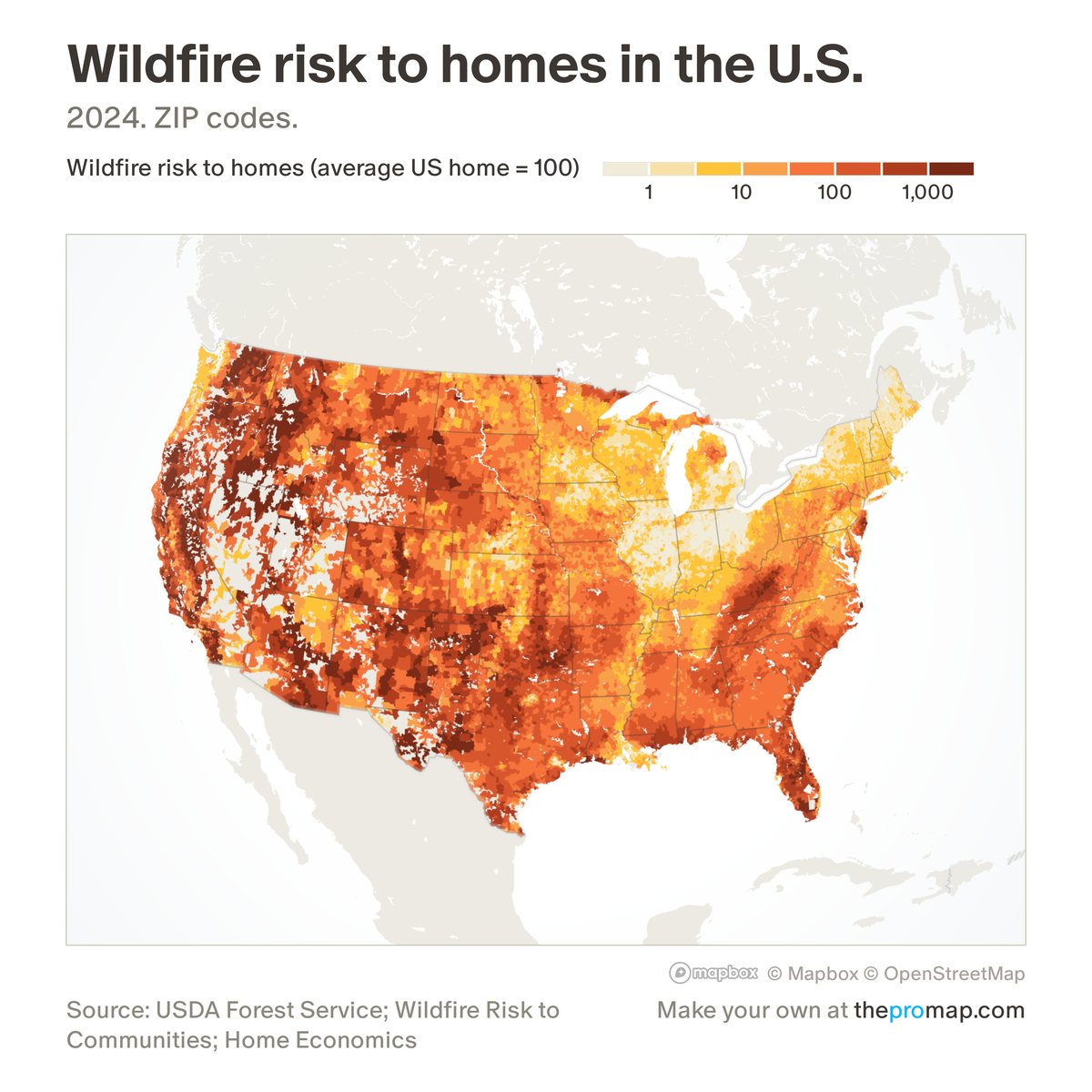
What this measure is
The Forest Service's expected yearly wildfire risk to housing, per home, scaled so that the average US home is 100: 300 means three times that risk and 10 a tenth of it. For each 30-metre grid cell the Forest Service combines the yearly chance of fire, how much damage a likely fire would do to a typical house, and the number of homes; Home Economics adds this up over the area and divides by its homes. It is an index for comparing places, not a dollar loss, and it does not reflect a single home's materials, cleared space or recent fires. Hatched areas have no figure: fewer than 10 homes.
Source, dates and coverage
- Source
- US Forest Service, Wildfire Risk to Communities; per-home figures by Home Economics.
- Updated
- A single estimate from the Forest Service's second edition (2024). Latest data on the map: 2024.
- Areas on the map
- States, metro areas, counties, ZIP codes and census tracts.
- Group
- Climate & hazard risk
- Access
- ProMap Plus ($19 a month or $190 a year).
Values for every place
Wildfire risk to homes is a ProMap Plus measure. The map shows it for the areas listed above. This page shows the map's national picture, the method and the source, and no figures.
ProMap Plus costs $19 a month or $190 a year. A free 7-day trial is offered on the map.
See wildfire risk to homes in ProMap PlusHow to cite
Please also credit the original source: US Forest Service, Wildfire Risk to Communities; per-home figures by Home Economics.